Description
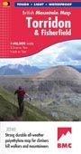
; "HARVEY British Mountain Maps are a joy to use. The detail and accuracy make them my first choice when I am researching a route or just out on the hills for fun". Peter Macfarlane, outdoor writer and photographer.; The giants of Torridon and the remote hills of Fisherfield on one sheet at scale 1:40,000 scale.; The map area includes 18 Munros and 12 Corbetts.; Enlargements at 1:15,000 scale of An Teallach, Beinn Alligin, Beinn Eighe and Liathach on the reverse.; Geological map of Torridon and Fisherfield; Printed on polyethylene - durable, tear-resistant and 100% waterproof; Made in cooperation with the British Mountaineering Council and the Mountaineering Council of Scotland; Colour shading for easy identification of hills and valleys; Climbing crags are highlighted and climbing route diagrams included.; Less than half the weight of a laminated map
Delivery
Delivery
Standard Delivery (£3.99)
FREE Delivery* on orders over £50. Delivered within 3-5 working days. A tracking link will be provided once your order is dispatched.
*Excludes bikes and some large items.
Click and Collect
Pay online now and the items will be delivered to store for you to collect. Orders will be kept in store for 14 days before being cancelled.
You will be notified when your order is ready to collect. Please do not travel to store until you have been notified.
Returns
Returns
Returning orders to us is easy. Whatever your reason, we offer a refund or exchange within 30 days of delivery or collection.
Complete the look
Related
FREE delivery* on orders £50+
*Excludes bikes & some other large items
Learn more about deliveries
30 day returns
Product Code: EAPUO4TI0041