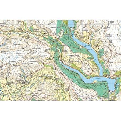
Description
Detailed map for runners and walkers of the eastern fells of the Lake District National Park at the magic scale of 1:40,000.
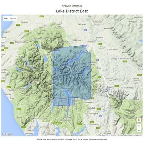
Features Helvellyn, High Street and fells east of the Kendal-Keswick road. The Kirkstone Pass, Ullswater, Haweswater and Kentmere are on this sheet.
Includes 82 Wainwrights.
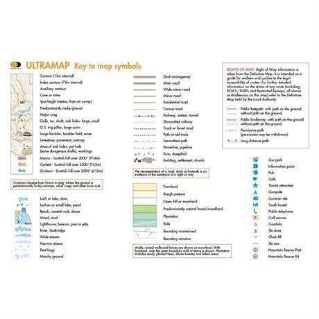
- Fully detailed genuine HARVEY mapping
- Includes Rights of Way
- Use without a map case: tough and 100% waterproof
- Opens directly to either side of the sheet
- Scale: 1:40,000
- Ratio: 2.5cm = 1km
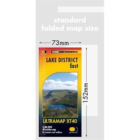
- Flat size: 870 x 304mm
- Folded size: 73 x 152mm
- Weight: 25gms
- Area of mapping: 663sqkm
- Double sided
Delivery
Delivery
Standard Delivery (£3.99)
FREE Delivery* on orders over £50. Delivered within 3-5 working days. A tracking link will be provided once your order is dispatched.
*Excludes bikes and some large items.
Click and Collect
Pay online now and the items will be delivered to store for you to collect. Orders will be kept in store for 14 days before being cancelled.
You will be notified when your order is ready to collect. Please do not travel to store until you have been notified.
Returns
Returns
Returning orders to us is easy. Whatever your reason, we offer a refund or exchange within 30 days of delivery or collection.
Complete the look
Related
FREE delivery* on orders £50+
*Excludes bikes & some other large items
Learn more about deliveries
30 day returns
Product Code: EAPUO4TI0617