Description
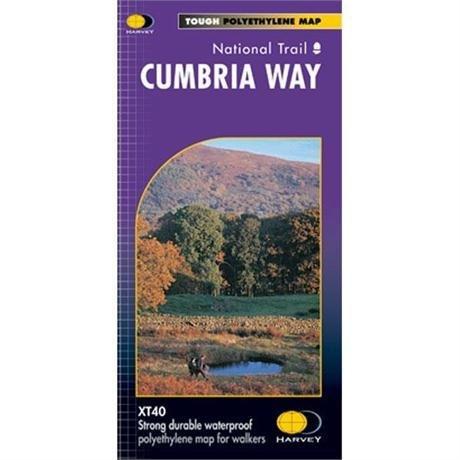
Harvey Map: Cumbria Way. The Cumbria Way is 112km (70 miles) from Ulverston to Carlisle. It passes through Coniston, Dungeon Ghyll, Keswick and Caldbeck, mostly through valleys rather than over high tops. This map shows the entire route on one sheet.
Compact and light - the map itself weighs just 60gms - a third of the weight of a laminated map, and much less bulky. You can fold or refold it time and again, or stuff it in your back pocket and it won't fall to pieces.
- Detailed mapping, full legend.
- National Grid - can be used with GPS.
- 1:40,000 scale.
- Waterproof. Supplied in clear plastic pocket
- Ranger Service contact numbers and enlargements of towns/villages showing facilities available and tips on weather and clothing
- Information on finding accommodation, camping, food. Directions to the start.
Delivery
Delivery
Standard Delivery (£3.99)
FREE Delivery* on orders over £50. Delivered within 3-5 working days. A tracking link will be provided once your order is dispatched.
*Excludes bikes and some large items.
Click and Collect
Pay online now and the items will be delivered to store for you to collect. Orders will be kept in store for 14 days before being cancelled.
You will be notified when your order is ready to collect. Please do not travel to store until you have been notified.
Returns
Returns
Returning orders to us is easy. Whatever your reason, we offer a refund or exchange within 30 days of delivery or collection.
Complete the look
Related
FREE delivery* on orders £50+
*Excludes bikes & some other large items
Learn more about deliveries
30 day returns
Product Code: EAPUO4TI0499